
From Space City Weather:
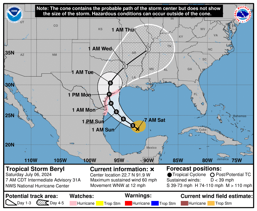
In brief: Although we cannot be certain at this time, it increasingly looks as though Tropical Storm Beryl is on track to make landfall somewhere between Corpus Christi and Matagorda Bay on Monday. For the greater Houston area this will result in higher winds, some storm surge, and heavy rainfall, with the greatest impacts likely on Monday. This post goes into what to tentatively expect, and when.
There is understandably a lot of consternation about the forecast for Beryl, which shifted considerably northward during the last day or two toward Houston. However, overnight the majority of our model guidance has stabilized on a landfall along the Coastal Bend of Texas, somewhere between Corpus Christi and Matagorda Bay.
Given the unpredictability of Beryl to date, I don’t blame anyone for being skeptical about this forecast. However there are a couple of reasons for increased confidence. Most importantly, we are only about 48 hours from landfall, and the average track error at this point is approximately 60 miles. And secondly, the models have stopped swinging about wildly and begun to consolidate on a solution.
In this post, we will discuss the effects of this “most likely” storm path on the greater Houston area, from Katy to Baytown, and Galveston to Conroe. For effects across the entire state of Texas, I would point you to The Eyewall.
That was the morning post yesterday, and there have been updates since. Go check both sites for the very latest. Even though Beryl is likely to be a fairly modest hurricane by the time it hits our coast, it’s notable because it was such a big storm so early in the season. We know how active this season is going to be, and that’s what it means. It’s not just about the number of storms, it’s about their size and intensity and frequency, and how early in the season they start and how late in the season they linger. Welcome to the future. I just hope the reservoirs get what they need. The Chron has more.
UPDATE: The Sunday morning report concludes as follow:
Beryl will be an impactful storm for the Houston region. This is far from a worst-case scenario hurricane for our area, but it will be significantly disruptive tonight and on Monday. Beginning this evening, you should shelter in your home. The worst of the winds and rains will come tonight and into Monday morning, with improving conditions thereafter. Due to the likelihood of street flooding on Monday morning, you should carefully consider any plans before noon.
Take heed.
Still nothing on the debate clusterfuck, Kuff, not even with Doggett, a TEXAS Congressman, calling for Biden to withdraw? Or Castro’s words?
Focus, McFly. This wasn’t a political post/story.
My 2 cents, we are going to get some rain.