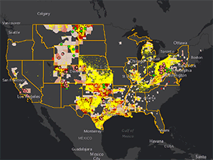
More than two million Texans live within a half-mile of an oil and gas facility, putting them at risk of exposure to toxic fumes, according to a new app released Wednesday by national environmental groups. The online tool — which includes a searchable map — places about a fifth of the state’s area, and more than 900 Texas schools and 75 medical facilities, in the half-mile range.
The app, created by Earthworks, Clean Air Task Force and FracTracker Alliance, is searchable by address and overlays the locations of oil and gas facilities and vulnerable populations with cancer and respiratory health risk information. An analysis published with the map also estimates that by 2017, 82 counties in Texas with a population of 4.1 million or more will face an elevated cancer risk.
“This [app] is so important in Texas is because of the political situation,” said Earthworks’ communications director, Alan Septoff. “The state has vowed never to regulate greenhouse gas emissions and there’s no chance the state of Texas is going to act.”
[…]
In June, about a month after the Obama administration announced plans to regulate methane leaks from new oil and gas facilities, the Texas Railroad Commission urged the state’s attorney general to sue the Environmental Protection Agency over the rules. Texas Railroad Commissioner David Porter has previously said the methane regulations “kill the jobs Texans rely on to support their families” and are “unnecessary” and “over-burdensome.”
Septoff said his group hopes both that the tool will be a resource to help folks living close to oil and gas activity understand the health risks they may be facing, as well as a push for the Obama administration to adopt methane regulations for facilities already in operation.
Here’s what the map for Texas looks like. There’s a ton of information on the webpage, with videos to help you use and understand the data. However you feel about regulations, you’re better off having full information available to you. Check it out.

