
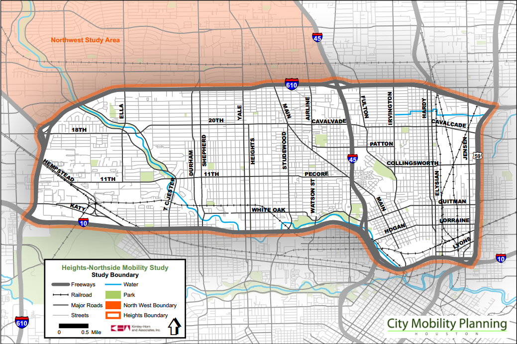
Mostly of interest for folks in my area, here’s the city’s report on mobility for neighborhoods in the upper left quadrant of the Inner Loop.
Final Report: Heights-Northside Sub-regional Mobility Study
The Planning and Development Department, in partnership with the Department of Public Works and Engineering and Houston-Galveston Area Council, is pleased to announce that the Heights-Northside Sub-regional Mobility study has been finalized and can be downloaded (see links below).
After an extensive public comment period, the City received 125 comments regarding study recommendations, and letters from area organizations. Over the last several months, the project team has worked with City staff to evaluate all comments and provide responses to questions that were raised. Where appropriate, recommendations were modified to ensure that all final recommendations resulting from this study best serve the needs of the City and community, alike.
Final Report: Heights-Northside Sub-regional Mobility Study
Download Full Version (31 MB)Download by Chapter:
I. Introduction
II. Existing Conditions
III. Community Involvement
IV. Defining Future Mobility Conditions
V. Changing Mobility Considerations
VI. A Balanced Approach: Corridor Sheets
VII. Outcomes
VIII. Next StepsAppendix A: Data Collection
Appendix B: Thoroughfare Types
Appendix C: Transit Analysis
Appendix D: Hardy-Elysian Option Considerations
Appendix E: Travel Demand Results
Here’s the project website, which has archives of past community meetings and won’t be around much longer. I was alerted to this by Bill Shirley, who highlighted the following bit from the Corridor Streets section that was of interest to me.
“Pedestrian facilities along Studewood Street are in great condition north of White Oak Drive, but virtually nonexistent along the 4-lane segment of the roadway south of White Oak Drive which includes a 4-lane bridge. However, the use of this segment by pedestrians is evident by foot paths flanking both sides of the corridor. The contra-flow lane confuses drivers who are not familiar with its function, and additional signage could help mitigate this issue. The contra-flow lane also causes problems at major intersection due to the lack of protected lefts. At its northern boundary, the corridor terminates into a 6-legged intersection with E 20th/N Main Street/W Cavalcade Street. The current intersection configuration creates confusion, particularly for the pedestrians and bicyclists to navigate.”
I wrote about this awhile back, in the context of the new housing development that will be coming in across the street from the Kroger at Studemont and I-10, and how that area could be a lot more desirable, and a lot less of a burden to vehicular traffic, if that sidewalk were finished and bike options were added. The latter is known to be coming as part of the Bayou Greenways initiative, and it’s exciting to see that the sidewalk is at least on the drawing board as well. I don’t know how long term some of these projects are, but I’m looking forward to them.